The canal is an artery for people to move around the city either on foot, by bike and wheel, or by boat – and we’re closer than you think!
Find us on foot
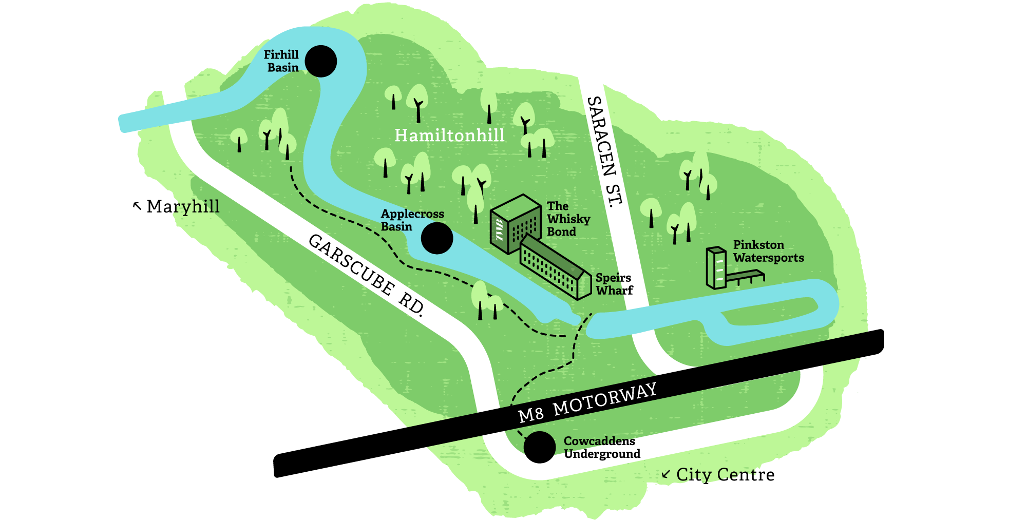
The waterway is currently accessible via key entry points located at North Canal Bank Street, the end of Civic Street , Speirs Wharf, Sawmillfield Street, The Whisky Bond, Applecross Street and Firhill Court.
Find us by subway
From Cowcaddens subway station, walk under the M8 underpass and take a right up the hill.
Find us by bus
The number 7, 7A and 75 buses all run to nearby Garscube Road from Glasgow Central Station.
Find us by boat
Take to the canal and see Glasgow from a whole new perspective. Whether you have your own boat, are hiring a boat, or taking a trip on someone else’s boat, Scottish Canals has all the advice you need. Visit the Scottish Canals website for more information.
Find us by bike
We are part of a UK-wide network of signed paths and routes for walking, cycling, wheeling and exploring outdoors.
Here’s just some of the Sustrans loops and links you can enjoy:
Bowling to the Falkirk Wheel
Travel along the Forth and Clyde canal between Glasgow and Falkirk on a wonderful, flat traffic-free route across central Scotland.
Glasgow Waterways Loop
A short circular ride around some of Glasgow’s historic waterways including the Forth and Clyde Canal.
Route 754
An entirely traffic-free cycle path from Edinburgh to Glasgow.
Route 756
An urban-character route
Parking
Leave the car behind and discover the hidden gems of Glasgow’s canal. You can park at the following locations to reach the waterside walkway:
Applecross Street
Accessible entrance to Applecross Basin, suitable for buggies and wheelchairs
Ellesmere Street
Accessible entrance to Applecross Basin
Sawmillfield Street
Access the canal here via a flight of steep stairs
Civic Street / Corn Street
Head up the pathway to access Speirs Wharf. One path is flat and smooth and another has low, wide steps.
North Canal Bank Street
To reach the top end of the canal